- -25%


Reference: TF-GIFT-GF-11
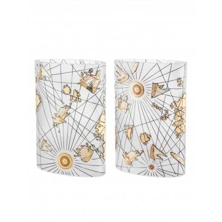
Paşabahçe - Pir-i Reis Map Vase

The Piri Reis World Map, which was prepared by integrating the truths and wrongs of twenty maps, including the lost map of Christopher Columbus, is a valuable historical document containing the geographical information of 16th century European and Muslim sailors.
The first world map drawn by Ottoman admiral Piri Reis in 1513 is one of the oldest maps showing the Americas. Torn across the right, the map shows the west coasts of Europe and Africa, and the east coast of South America.The original map is 90 x 65 cm in size, decorated with various colors, pictures and writings on gazelle skin.
The original of the map is in Topkapı Palace today.
Diameter : 18 cm
Height : 25 cm It is
100% handmade.
Product Origin : Turkey
Cleaning Suggestion: Wipe with a dry cloth.
Paşabahçe - Pir-i Reis Map Vase
Paşabahçe Ottoman Collection - Has Room Sherbet Glass
Pasabahce - Bereket Pomegranate Accessory
Paşabahçe - Handmade - Popart Mask 5 - Madein Turkey
Paşabahçe - Turquoise Ebru Evil Eye Diameter 12 cm
Pasabahce Popart Mask 1- Hand Made Gift - Madein Turkey
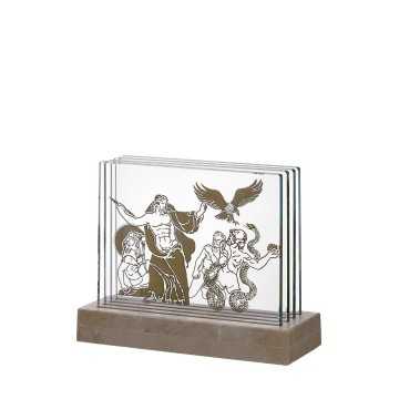
Paşabahçe - War of Giants Object